|

|
|
| Product Information: | ||
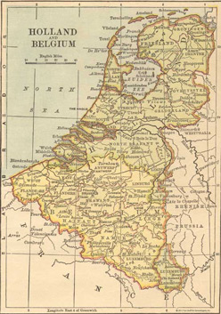
| Details: | 1882 Map of Holland & Belgium; by Philip Van Ness Myers; 1 pp; Map; 10.5x14; published: 1873; Item # FS066 This is a full color reproduction of an 1882 map of Holland and Belgium. First published in The Independent Course, Comprehensive Geography, Local, Mathematical, Physical, Comparative, Descriptive, Topical, Historical & Ancient with Map-Drawing & Relief Maps .All of our maps come in a protective, archival safe sleeve. |
|